Case Studies – Tumby Bay Flood Mitigation Works
-
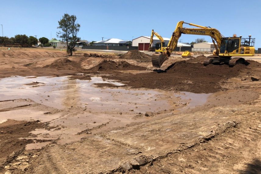
Shaping of wetland retention/detention basin
-
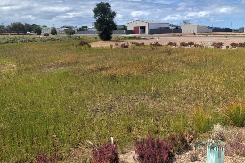
Completed wetland retention/detention basin
-
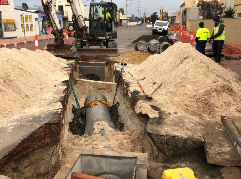
Upgraded sub-surface drainage systems
-
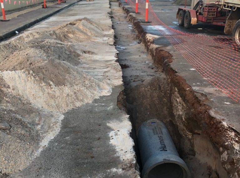
Upgraded sub-surface drainage systems
-
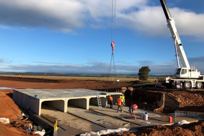
Major culvert upgrade on Milne Hill Creek
Quick Facts
Project Proponent(s): District Council of Tumby Bay
Project Manager(s): District Council of Tumby Bay and Southfront Consulting Engineers
Principal Contractor(s): McMahon Services
Total Cost: $4.8 million
SMA Contribution: $978,000
Other Funding Contributors:
• Australian Government Building Better Regions Fund
• Eyre Peninsula Landscape Board
Tumby Bay is located on the eastern coastline of Eyre Peninsula, approximately 50 kilometres north of Port Lincoln. The town was established as an agricultural hub, built around the jetty used for export of grain and wool and elevated on the original foreshore dune system. As the town grew, development spread into lower lying land at the rear of the dune with associated flooding risk during large rainfall events. The interaction with the Tumby Bay wetlands to the south, and reliance on coastal discharges meant that the stormwater system for large areas of the town was compromised during high tide events.
Following a significant rainfall and flooding event in 2011, Tumby Bay Council, with support from the Stormwater Management Authority, commissioned a Stormwater Management Plan (SMP) through Southfront Consulting Engineers. This plan, adopted in 2014, identified a number of constraints and opportunities for improvement in the management of flooding risk, water quality and township amenity. Critically, the plan identified both the existing and future development scenario risks to property, and demonstrated that flood prone land was a significant limitation to the future development of Tumby Bay. Key to the SMP was managing flow from a significant rural catchment inland from the town, controlling the impact of high tide conditions on stormwater outfalls and providing sufficient catchment storage for local runoff within Tumby Bay. Recommended solutions included upgrade of an existing flood levy, channel and major culvert to the north of town, creation of wetland areas providing stormwater retention capability and the installation of flood gates to prevent tidal impact on the stormwater system. Water quality improvements via a number of raingardens and coastal infiltration basins were recommended, and new and upgraded sub-surface drains proposed to manage local sub-catchment drainage within the town. Open space enhancements using drainage easements for access and passive recreation opportunities were integrated into the plans to align with the Tumby Bay Masterplan and Urban Design Framework.
Following detailed design in 2017, funding was secured from the Building Better Regions fund and Stormwater Management Fund in 2018. Works commenced in January 2019. Major contract works were completed in September 2019 with final landscaping works continuing through until June 2020. The site was officially opened in February 2021 after COVID restrictions eased and guests were able to view well established wetlands, raingardens and infiltration basins, along with new residential development on land that, prior to the implemented works, would have been at risk of future flooding events.